Lake Atitlán
📍 Sololá, southwestern Guatemala highlands
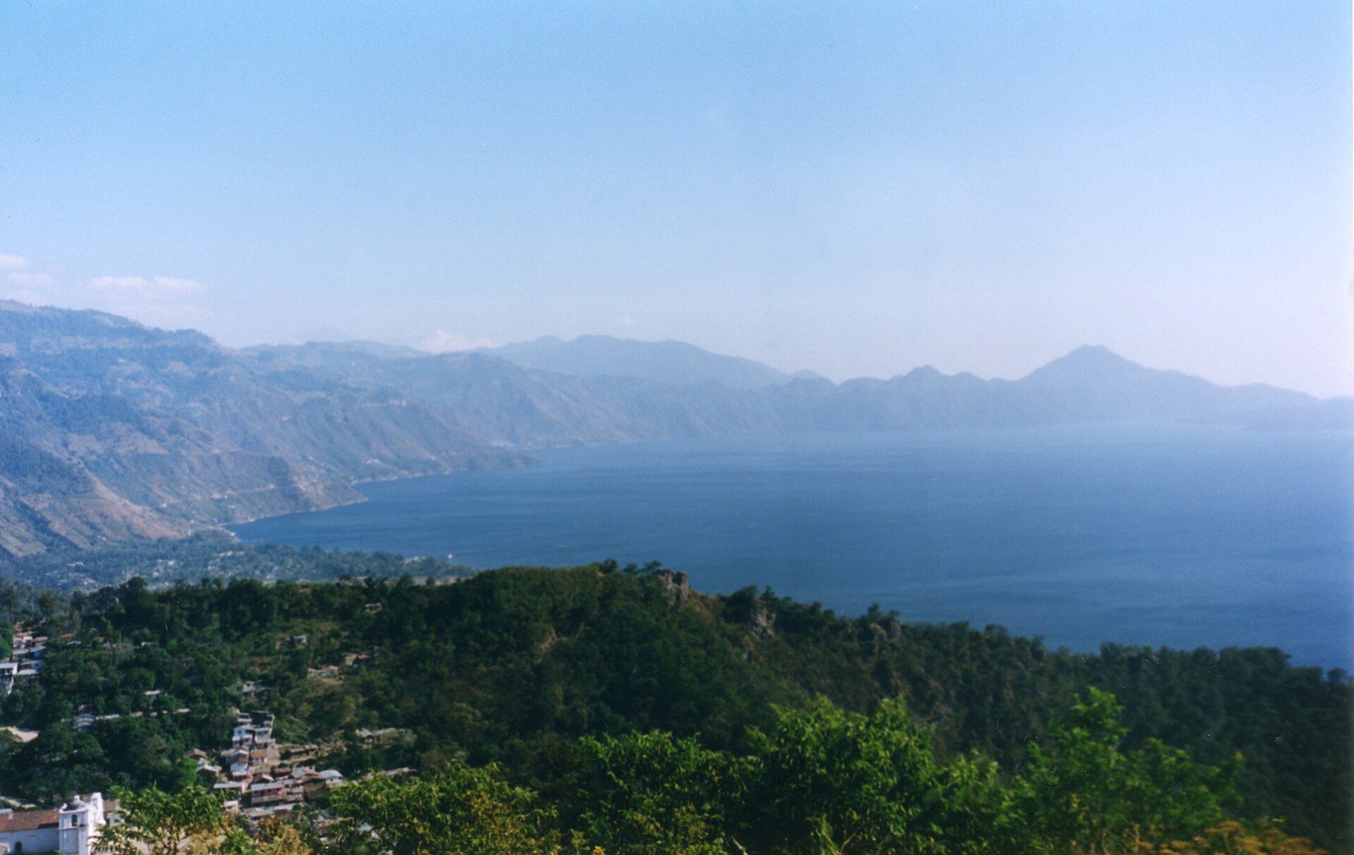
A deep blue volcanic lake cradled in a highland caldera and ringed by three perfect volcanic cones and Maya villages — long called one of the most beautiful lakes on Earth.
What makes it marvelous
Lake Atitlán fills a vast caldera left by a colossal volcanic eruption some 84,000 years ago, its basin later dammed and deepened until the water reached over 300 metres deep — among the deepest lakes in Central America. Three younger stratovolcanoes — San Pedro, Tolimán, and Atitlán — rise in near-perfect cones from its southern shore. Sitting at around 1,560 metres in the Guatemalan highlands, its deep blue water and volcanic backdrop have drawn superlatives for a century.
Why visit
The lake is ringed by Maya villages, each with its own character, linked by little passenger boats that skim across the water beneath the volcanoes. You can hike the cones, kayak the shoreline, visit weaving and market towns like Panajachel and Santiago Atitlán, and watch the light shift on the water from dawn mist to golden evening. It is highland Guatemala at its most beautiful and most alive with living Maya culture.
More views of Lake Atitlán
Additional photographs of the actual site — each freely licensed, with its photographer and licence credited.
What to know before you go
🗓️ Best time
The dry season, roughly November to April, brings the clearest skies and calmest mornings; afternoons often see a strong wind, the Xocomil, ruffle the lake year-round.
🧭 Getting there & access
About 3 hours by road from Guatemala City or Antigua to Panajachel, the main gateway town on the north shore. Villages around the lake are connected by frequent public launch boats rather than roads.
Good to know
- Cross the lake in the morning — the afternoon Xocomil wind whips up choppy water.
- Base in a village that suits you: lively Panajachel, tranquil San Marcos, or traditional Santiago.
- Bring layers; the highland evenings are cool despite the tropical latitude.
Plan your visit
Easy🧭 Getting there
From Guatemala City (GUA) or Antigua
- Fly to Guatemala City
- Road to Panajachel on the lake's north shore — about 3h from the city or Antigua
- Public launch boats to the villages around the shore
- Total travel
- Half a day from Guatemala City or Antigua
- Time at site
- 2–3 days to explore several villages and hike or kayak
- Access
- No permit for the lake. Public launches run frequently between villages by day; agree fares in advance. Volcano hikes (San Pedro, and the tougher Tolimán and Atitlán) are best with a local guide and an early start.
🎒 What to bring & consider
- A warm layer for cool highland mornings and evenings
- Sun protection; the high-altitude light is strong on the water
- Small cash for boats, markets, and village stays
- Good shoes if you plan to climb one of the volcanoes
👁️ What to expect
- Crowds
- Panajachel and San Pedro are busy; quieter villages and early boats offer calm. The lake is large enough to absorb visitors.
- Conditions
- Calm mornings and windy, choppy afternoons on the water; steep, demanding climbs on the volcanoes.
- Facilities
- Full range in Panajachel and the larger villages — hotels, food, boats; simpler in the small settlements.
- The view
- The three volcanoes across the blue lake at dawn, before the Xocomil wind rises. Morning light and calm water are everything here.
Times and requirements are approximate and change with season, weather, and local rules — confirm permits, fares, and schedules with operators before you travel.
Natural riches of the area
- A deep caldera lake formed by an ancient super-eruption
- Three stratovolcanoes — San Pedro, Tolimán, and Atitlán
- Highland cloud and pine-oak forest on the surrounding slopes
- Endemic and migratory birdlife around the shore
Local food
- Pepián
- A rich, spiced Guatemalan stew thickened with toasted seeds and chillies.
- Highland coffee
- Arabica grown on the volcanic slopes around the lake.
Lake Atitlán sits in the crater of an ancient catastrophe. Some 84,000 years ago a massive eruption emptied a magma chamber and left a vast caldera, which slowly filled to form a lake now over 300 metres deep, held at around 1,560 metres in the Guatemalan highlands. From its southern shore rise three younger volcanoes in almost textbook cones — San Pedro, Tolimán, and Atitlán — and their reflection in the deep blue water is the image that has drawn travellers and writers to call it one of the most beautiful lakes in the world.
What makes it more than a view is the life around it: a ring of Maya villages, each distinct, connected not by roads but by little launch boats that dart across the water. You can wake to mist on the lake, cross to a weaving town or a lively travellers’ village, climb a volcano, or simply watch the afternoon Xocomil wind stir the surface. It is a place where a dramatic volcanic landscape and a living highland culture share the same shore.
Lake Atitlán: common questions
How do you get to Lake Atitlán?
From Guatemala City (GUA) or Antigua: Fly to Guatemala City; Road to Panajachel on the lake's north shore — about 3h from the city or Antigua; Public launch boats to the villages around the shore. Allow Half a day from Guatemala City or Antigua.
When is the best time to visit Lake Atitlán?
The dry season, roughly November to April, brings the clearest skies and calmest mornings; afternoons often see a strong wind, the Xocomil, ruffle the lake year-round.
How long should you spend at Lake Atitlán?
2–3 days to explore several villages and hike or kayak. Half a day from Guatemala City or Antigua of travel from Guatemala City (GUA) or Antigua.
What should you bring to Lake Atitlán?
A warm layer for cool highland mornings and evenings Sun protection; the high-altitude light is strong on the water Small cash for boats, markets, and village stays Good shoes if you plan to climb one of the volcanoes
Do you need a permit or guide for Lake Atitlán?
No permit for the lake. Public launches run frequently between villages by day; agree fares in advance. Volcano hikes (San Pedro, and the tougher Tolimán and Atitlán) are best with a local guide and an early start.
Is Lake Atitlán crowded, and what are conditions like?
Panajachel and San Pedro are busy; quieter villages and early boats offer calm. The lake is large enough to absorb visitors. Calm mornings and windy, choppy afternoons on the water; steep, demanding climbs on the volcanoes. Facilities: full range in Panajachel and the larger villages — hotels, food, boats; simpler in the small settlements.
Added
More wonders to explore