Nature route · A week
Luzon Volcano Trail
Four of the country's great volcanoes, north to south — a lesson in fire down the spine of Luzon.
A thematic route linking four very different volcanoes down the length of Luzon: the crater-lake trek of Pinatubo, the volcano-in-a-lake at Taal, the perfect cone of Mayon, and Bulusan's rainforest caldera — the Ring of Fire, made walkable.
- Length 6–7 days
- Stops 4 wonders
- Budget ₱15,000–40,000 pp
- Region Luzon, Philippines
Trip map
The route
Stops in travel order — tap any one for the full wonder guide.
-
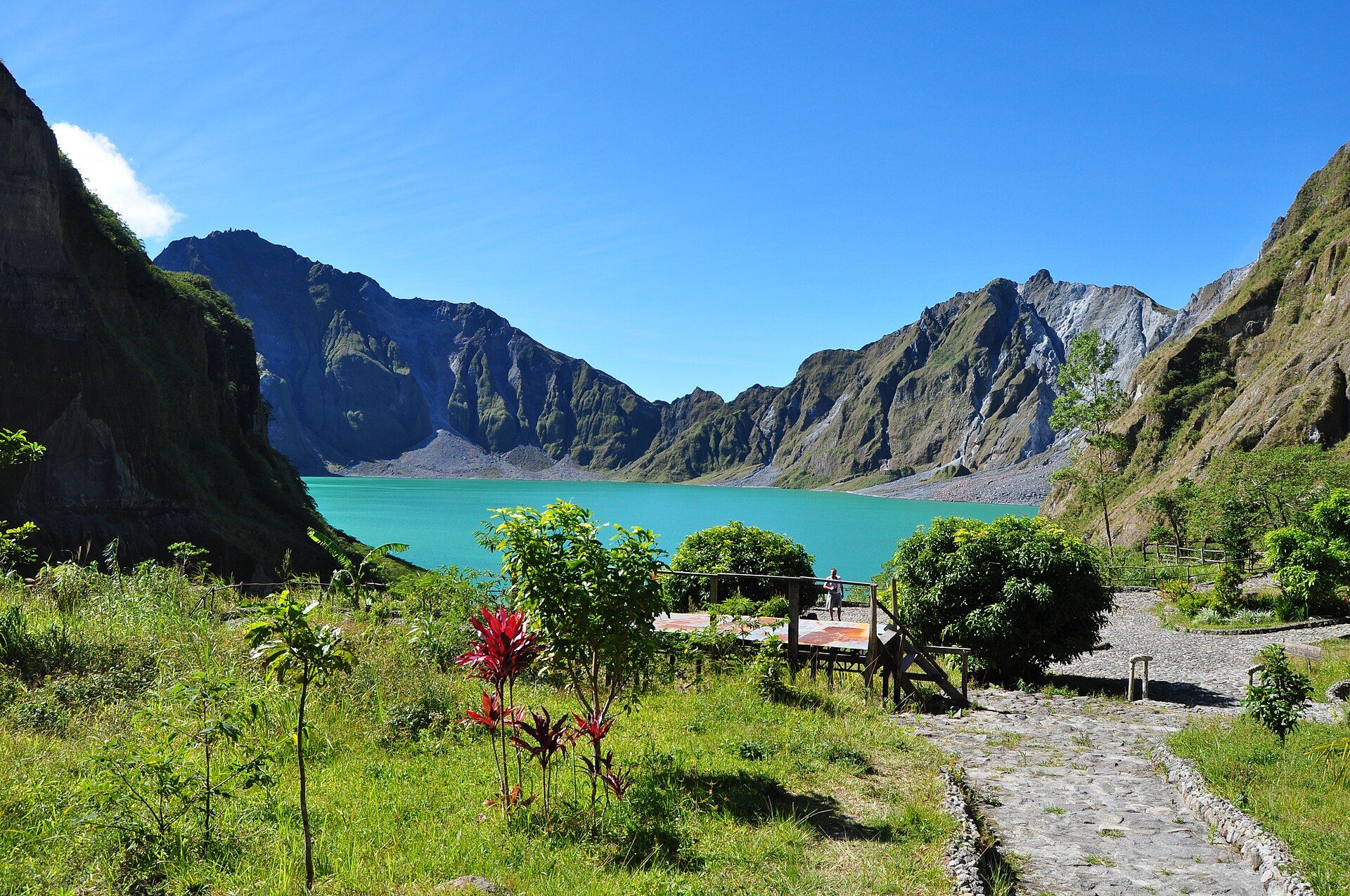
Mount Pinatubo Crater Lake 1 night
Zambales / Tarlac / Pampanga, Luzon, Philippines
The 1991 caldera and its turquoise crater lake — a 4x4-and-trek day northwest of Manila.
-
Taal Volcano & Lake 1 night
Batangas, Calabarzon, Philippines
One of the world's smallest active volcanoes, an island in a lake in a caldera, viewed from the Tagaytay ridge.
-
Mayon Volcano 2 nights
Albay, Bicol Region, Philippines
The near-perfect cone over Legazpi — the trail's fiery centrepiece, reached by a short Bicol flight.
-
Bulusan Volcano & Lake 1 night
Sorsogon, Bicol, Philippines
Mayon's green opposite — an active, rainforest-cloaked volcano cradling a still crater-foot lake in Sorsogon.
Day by day
-
Manila to Pinatubo
Base Capas/Santa Juliana, Tarlac
- Manila to the Pinatubo jump-off — about 3–4h
Reposition northwest of Manila to the Pinatubo staging point and rest for a first-light crater trip.
-
Pinatubo crater, south to Taal
Base Tagaytay, Cavite
- 4x4 across the lahar plain plus a 1–2h trek to the crater rim
- Long transfer around Manila to Tagaytay — about 4–5h
Walk to the turquoise crater lake in the 1991 caldera, then cross to the Taal caldera's cool ridge for the night.
-
Taal, then fly to Bicol
Base Legazpi, Albay
- Morning on the Tagaytay ridge over Taal
- Return to Manila and fly to Legazpi — flight about 1h
Take in the volcano-in-a-lake from the ridge (island access depends on the alert level), then fly south to Bicol and the shadow of Mayon.
-
Mayon up close
Base Legazpi, Albay
Circle Mayon through Albay's viewpoints — the Cagsawa ruins framing the cone, an ATV run across the lava field. Keep to the safe vantages; the summit is off-limits.
-
South to Bulusan
Base Bulusan/Irosin, Sorsogon
- Legazpi to Bulusan via Sorsogon City — about 2.5–3h
Drive into Sorsogon to Bulusan's rainforest. Walk or paddle the forest-ringed lake and soak in a spring nearby (check the alert level first).
-
Bulusan, then homeward
Base Legazpi / onward
- Return to Legazpi for the flight home — about 2.5–3h back
A last forest morning at Bulusan before returning to Legazpi to fly out — or press on to pair with the Bicol Fire & Water route.
What it costs
Per person, two sharing, 6 nights, including one domestic flight (Manila–Legazpi return). Excludes shopping.
| Category | Range (per person) |
|---|---|
| TransportVans/self-drive around Luzon plus the Manila–Legazpi flight; flights swing with season and lead time. | ₱4,000–10,000 |
| Lodging6 nights, guesthouses to mid-range hotels in Tagaytay and Legazpi. | ₱4,500–14,000 |
| FoodLocal eateries and Tagaytay/Bicol cafés. | ₱3,000–7,000 |
| Fees & guidesPinatubo 4x4 + guide, Mayon ATV, Taal viewpoints, Bulusan park. | ₱3,500–9,000 |
| Estimated total | ₱15,000–40,000 |
What moves the number
- Whether you fly to Bicol or take an overnight coach (cheaper, slower)
- Public transport vs a hired van or self-drive around Luzon
- Group size for the Pinatubo 4x4 and Mayon ATV
- Season and booking lead time
Indicative mid-2026 ranges; confirm current fares, permits, and rates before booking. Roughly US$265–710 per person at mid-2026 exchange rates. These are honest ranges, not quotes — real prices swing with season, group size, and how you travel. Always confirm current fares, room rates, permits, and fees with operators before you commit.
Best season & getting around
🗓️ Best time to go
March to May is the sweet spot, when Bicol's Mayon and Bulusan are at their clearest and driest and the Luzon volcanoes are all in their dry season. The wider dry window (November to May) works for Pinatubo and Taal; avoid the June–October rains and typhoons, which hit Bicol hard. Every leg also depends on the PHIVOLCS alert levels.
🧭 Getting around
Land travel from Manila for Pinatubo and Taal (hired van or self-drive is easiest), then a short domestic flight Manila–Legazpi to reach Bicol without a long overland haul. Pinatubo is a guided 4x4 trip; Mayon, Taal, and Bulusan are visited from the safe vantages with local operators and fees on the day.
Know before you go
- Every stop is an active volcano — check the PHIVOLCS alert level for each; a raised level closes the danger zone and can reroute the trip.
- Pinatubo is a guided 4x4-plus-trek day that starts before dawn; the summit of Mayon and the Taal island are off-limits when alerts are raised.
- Bicol takes the typhoon season hard — plan firmly for the dry months and keep a buffer day.
- Distances and times are approximate and shift with traffic, weather, and roadworks.
The Philippines rides the Pacific Ring of Fire, and nowhere is that clearer than down the spine of Luzon, where volcano after volcano rises from the plains and coasts. This thematic trail strings four of the most striking together in a single north-to-south run: Pinatubo, whose 1991 eruption was one of the largest of the twentieth century and left a lake of startling blue; Taal, a tiny active cone sitting in a lake within a caldera; Mayon, as close to a geometric ideal as a volcano gets; and Bulusan, a green, restless massif wrapped in rainforest.
It is a trip built on respect for the mountains’ moods — every day begins with the PHIVOLCS bulletin, and the itinerary keeps to the safe vantages. Come in the dry months, fly the Bicol leg to save a long haul, and read the four volcanoes as a single story: the fire that built the islands, and keeps building them still.
Luzon Volcano Trail: common questions
How many days is the Luzon Volcano Trail?
6–7 days — the plan is built around 6 nights. ~700 km north-to-south down Luzon, plus a Bicol flight or night coach
When is the best time to do the Luzon Volcano Trail?
March to May is the sweet spot, when Bicol's Mayon and Bulusan are at their clearest and driest and the Luzon volcanoes are all in their dry season. The wider dry window (November to May) works for Pinatubo and Taal; avoid the June–October rains and typhoons, which hit Bicol hard. Every leg also depends on the PHIVOLCS alert levels.
How much does the Luzon Volcano Trail cost?
A rough guide is ₱15,000–40,000 per person (Per person, two sharing, 6 nights, including one domestic flight (Manila–Legazpi return). Excludes shopping.). Indicative mid-2026 ranges; confirm current fares, permits, and rates before booking. It varies with whether you fly to bicol or take an overnight coach (cheaper, slower), public transport vs a hired van or self-drive around luzon, group size for the pinatubo 4x4 and mayon atv.
How do you get around on the Luzon Volcano Trail?
Land travel from Manila for Pinatubo and Taal (hired van or self-drive is easiest), then a short domestic flight Manila–Legazpi to reach Bicol without a long overland haul. Pinatubo is a guided 4x4 trip; Mayon, Taal, and Bulusan are visited from the safe vantages with local operators and fees on the day.
Which natural wonders does the Luzon Volcano Trail include?
Mount Pinatubo Crater Lake, Taal Volcano & Lake, Mayon Volcano, Bulusan Volcano & Lake.
Added