Biri Rock Formations
📍 Biri Island, Northern Samar, Eastern Visayas
Massive sandstone rock formations on a remote island where the Pacific Ocean meets the ferocious San Bernardino Strait — sculpted over millennia into cliffs, arches, and tidal pools battered by giant waves.
What makes it marvelous
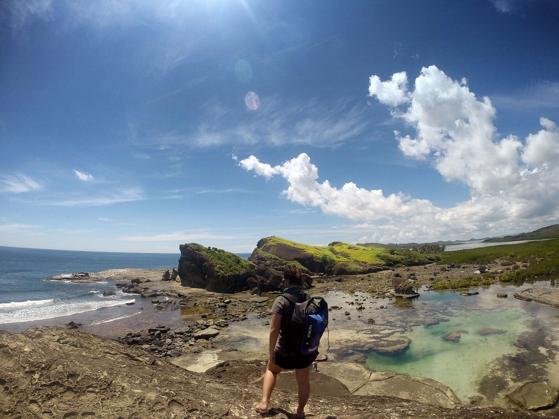
Biri sits at the meeting point of the open Pacific and the San Bernardino Strait, one of the roughest tidal channels in the Philippines. The relentless collision of ocean swell and racing tidal currents has carved the island's sandstone into seven great formations — Magasang, Macadlaw, Puhunan, and others — a landscape of layered cliffs, sea arches, and natural tidal pools where you can bathe as waves explode against the rocks just metres away.
Why visit
It's raw, elemental scenery well off the tourist trail: climbing the wind-scoured rock terraces at low tide, soaking in natural pools while the Pacific hammers the seaward cliffs, and watching the strait's powerful currents. Sunrise and sunset over the formations are spectacular.
What to know before you go
🗓️ Best time
The drier, calmer months (roughly March–June); the seas here can be very rough, and the formations are best explored at low tide.
🧭 Getting there & access
From Catarman or Allen in Northern Samar to Lavezares, then a boat crossing to Biri Island. Local guides run trips to the formations; go at low tide.
Good to know
- Explore at low tide and heed guides about currents — the strait is dangerous.
- Wear sturdy footwear for the sharp, uneven rock.
- Time sunrise or sunset for the best light on the formations.
Natural riches of the area
- Layered sandstone sculpted by ocean and tidal forces
- Powerful tidal currents of the San Bernardino Strait
- Tidal pools and rich intertidal marine life
- Seaweed farming and coastal fisheries
Local food
- Fresh seafood
- Fish, crab, and shellfish from the surrounding productive waters.
- Seaweed (guso) salad
- Locally farmed seaweed dressed with vinegar — a Samar staple.
- Native rice cakes
- Coconut-and-rice kakanin from the island's kitchens.
Biri is where the Philippines takes the full force of the Pacific. The little island sits at the mouth of the San Bernardino Strait, one of the country’s roughest tidal channels, and the endless battle between ocean swell and racing currents has sculpted its sandstone into seven monumental formations — layered cliffs, arches, and wave-scoured terraces named Magasang, Macadlaw, Puhunan, and more.
At low tide you can climb across the rock and settle into natural tidal pools while, just beyond, the open Pacific detonates against the seaward cliffs in sheets of spray. It’s elemental, uncrowded, and genuinely thrilling — a landscape that exists purely because of where it stands, in the path of the sea. Come at low tide, respect the currents, and stay for the light at either end of the day.
More wonders to explore