Cocora Valley
📍 Quindío, Coffee Region, Colombia
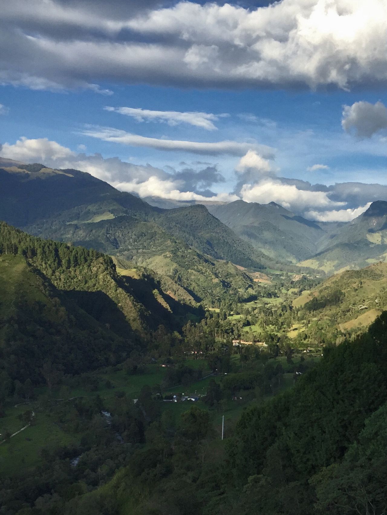
A green Andean valley where the tallest palm trees on Earth — Colombia's slender wax palms — soar up to 60 metres above misty cloud-forest hills, an almost dreamlike landscape in the heart of coffee country.
What makes it marvelous
The Cocora Valley is the stronghold of the Quindío wax palm, Colombia's national tree and the tallest palm species in the world, reaching around 60 metres. Improbably, these towering palms thrive at high altitude in cool Andean cloud forest — a relic of ancient forests, now protected after centuries of logging. Rising like green columns from rolling pasture and mist, often with their crowns in cloud, they create a scene unlike any other palm landscape on Earth, within a biodiverse cloud-forest ecosystem rich in birds, including hummingbirds and the endangered yellow-eared parrot.
Why visit
Walking or riding through the valley among the impossibly tall, slender palms — mist drifting between them, green hills all around — is serene and surreal. It sits within Colombia's UNESCO-listed Coffee Cultural Landscape, so a visit pairs naturally with the region's famous coffee farms.
What to know before you go
🗓️ Best time
Colombia's Andes are green year-round; the drier windows (roughly December–March and July–August) mean clearer trails, though mist among the palms is part of the magic.
🧭 Getting there & access
From Salento in the Quindío department (via Armenia or Pereira), a short ride to the valley trailheads. Loop hikes and horseback rides explore the palms and cloud forest.
Good to know
- Start early for the clearest views before afternoon cloud builds.
- Wear boots — the trails can be muddy in the cloud forest.
- Combine the valley with a coffee-farm visit in the surrounding region.
Plan your visit
Moderate🧭 Getting there
From Salento, Quindío, Colombia
- Fly Bogotá → Pereira or Armenia, then drive to Salento — roughly 1h
- Take a shared Willys jeep from Salento's main square → the Cocora trailhead — about 30 minutes
- Walk the valley loop among the wax palms — roughly 5–6 hours for the full circuit
- Total travel
- Under an hour from Salento to the trailhead
- Time at site
- Half a day for the loop, less for the palms alone
- Access
- Getting there is half the fun — the open Willys jeeps run from Salento's square on a rolling schedule and are the standard way in. There is a small entry fee on parts of the private land the loop crosses. The valley sits at altitude and the weather is reliably wet: cloud and rain build through the afternoon almost daily, so the palms are clearest and the trail least muddy early in the morning. The full loop through the cloud forest involves stream crossings on simple bridges that get slick.
🎒 What to bring & consider
- An early start, because the towering palms stand clear in the morning and vanish into cloud and rain most afternoons
- Waterproofs and boots with grip, since this is cloud forest and the trail is muddy and the log bridges are slippery
- A light layer for the altitude, which sits around 2,400m and higher and is cooler than the lowland cities you flew into
- Small notes for the jeep and the entry fees along the loop
- Insect repellent for the forested lower sections, applied before rather than during the walk
👁️ What to expect
- Crowds
- Busy at the lower viewpoint where the jeeps drop off, thinning fast on the full forest loop.
- Conditions
- Green, damp and often misty, with a mix of open valley and muddy cloud-forest trail.
- Facilities
- Cafés and toilets at the trailhead cluster; nothing on the loop itself. Salento has everything.
- The view
- The impossibly tall wax palms — the world's tallest, and Colombia's national tree — rising out of low cloud on the green hillsides, caught in the morning before the weather closes in.
Times and requirements are approximate and change with season, weather, and local rules — confirm permits, fares, and schedules with operators before you travel.
Natural riches of the area
- The world's tallest palm (the Quindío wax palm)
- Andean cloud forest and its watersheds
- Rich birdlife, including the endangered yellow-eared parrot
- Fertile slopes of Colombia's celebrated coffee region
Local food
- Trucha (trout)
- Farmed Andean trout, a Salento specialty, often with patacones.
- Bandeja paisa
- A hearty regional platter of beans, rice, meat, plantain, and egg.
- Colombian coffee
- From the surrounding UNESCO-listed Coffee Cultural Landscape.
The Cocora Valley turns a familiar tree into something astonishing. Here grow Colombia’s wax palms — the national tree and the tallest palm species on Earth — soaring up to 60 metres, impossibly slender green columns rising from cool Andean cloud forest. Palms are supposed to belong on tropical beaches; these thrive at high altitude in the mist, a living relic of ancient forests, now protected after centuries of logging thinned them.
Walking among them, with cloud drifting between the trunks and green hills rolling away on every side, is serene and slightly unreal. The valley is part of Colombia’s coffee country and its UNESCO Coffee Cultural Landscape, and the surrounding cloud forest hums with birdlife, from hummingbirds to the endangered yellow-eared parrot that depends on the palms. It’s one of those places that quietly rearranges your sense of what a landscape can look like.
Cocora Valley: common questions
How do you get to Cocora Valley?
From Salento, Quindío, Colombia: Fly Bogotá → Pereira or Armenia, then drive to Salento — roughly 1h; Take a shared Willys jeep from Salento's main square → the Cocora trailhead — about 30 minutes; Walk the valley loop among the wax palms — roughly 5–6 hours for the full circuit. Allow Under an hour from Salento to the trailhead.
When is the best time to visit Cocora Valley?
Colombia's Andes are green year-round; the drier windows (roughly December–March and July–August) mean clearer trails, though mist among the palms is part of the magic.
How long should you spend at Cocora Valley?
Half a day for the loop, less for the palms alone. Under an hour from Salento to the trailhead of travel from Salento, Quindío, Colombia.
What should you bring to Cocora Valley?
An early start, because the towering palms stand clear in the morning and vanish into cloud and rain most afternoons Waterproofs and boots with grip, since this is cloud forest and the trail is muddy and the log bridges are slippery A light layer for the altitude, which sits around 2,400m and higher and is cooler than the lowland cities you flew into Small notes for the jeep and the entry fees along the loop Insect repellent for the forested lower sections, applied before rather than during the walk
Do you need a permit or guide for Cocora Valley?
Getting there is half the fun — the open Willys jeeps run from Salento's square on a rolling schedule and are the standard way in. There is a small entry fee on parts of the private land the loop crosses. The valley sits at altitude and the weather is reliably wet: cloud and rain build through the afternoon almost daily, so the palms are clearest and the trail least muddy early in the morning. The full loop through the cloud forest involves stream crossings on simple bridges that get slick.
Is Cocora Valley crowded, and what are conditions like?
Busy at the lower viewpoint where the jeeps drop off, thinning fast on the full forest loop. Green, damp and often misty, with a mix of open valley and muddy cloud-forest trail. Facilities: cafés and toilets at the trailhead cluster; nothing on the loop itself. Salento has everything.
Added Updated
More wonders to explore