Caramoan Islands
📍 Caramoan, Camarines Sur, Bicol, Philippines
A remote Bicol peninsula where jagged limestone islets, hidden lagoons, and pocket white-sand beaches crowd a warm, reef-fringed sea — an El Nido–like seascape on the Pacific side of Luzon.
What makes it marvelous
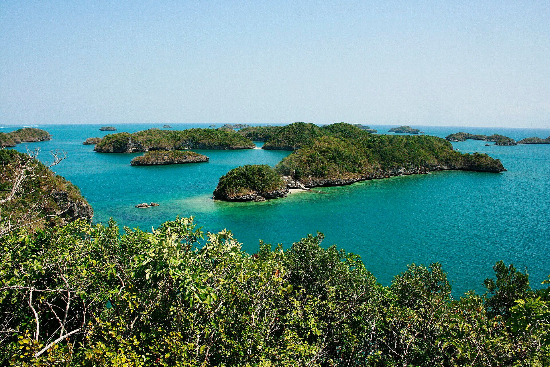
Off the tip of the Caramoan Peninsula, a scatter of karst islands rises straight from the water: weathered limestone towers, sea caves, and secret lagoons reachable only at the right tide. The same rock that built the peninsula's national park has been dissolved and undercut by the sea into cliffs and coves, with crescents of fine white sand tucked between them. Sheltered channels hold coral gardens, and the islands' isolation on the storm-facing east of Luzon has kept them comparatively wild.
Why visit
Caramoan gives you the drama of Palawan's karst without the crowds — a full day of island-hopping between Matukad, Lahos, Cotivas, and Sabitang Laya, swimming into hidden lagoons and landing on beaches with a single fishing boat for company. Its cinematic looks made it a repeat host for international 'Survivor' seasons; for a traveller it is simply one of the loveliest, least-developed island seascapes in Luzon.
What to know before you go
🗓️ Best time
March to May, the dry Bicol season, brings the calmest crossings and clearest water for island-hopping. This coast faces the Pacific and takes the brunt of the typhoon season (roughly June to December), when boats are often grounded — plan firmly for the dry months and keep buffer days for weather.
🧭 Getting there & access
Reached via the Bicol hub of Naga (nearest airport) by land to Sabang port, then a boat of roughly 1.5–2 hours across Lagonoy Gulf to Guijalo port near Caramoan town; island-hopping is by hired banca. Crossings depend entirely on sea conditions. Boatmen and a tourism fee are arranged in town.
Good to know
- Build in buffer days: the open-gulf crossing and island trips are weather-dependent and can be cancelled outright in rough seas.
- Go with accredited local boatmen and settle the island-hopping route and fees before setting out.
- Bring cash, reef-safe sunscreen, and water — the islands have little to no facilities or shade.
Natural riches of the area
- Limestone karst islands, sea caves, and hidden tidal lagoons
- Coral reefs and seagrass in the sheltered channels
- White-sand beaches and coastal mangroves
- Caramoan National Park forest on the peninsula
Local food
- Bicol Express
- The region's signature stew of pork simmered in coconut milk with fierce siling labuyo chillies.
- Pili nuts
- Bicol's buttery native nut, eaten roasted, candied, or as a rich local sweet.
- Kinunot
- Flaked fish or ray cooked in coconut milk with malunggay leaves — a Bicolano coastal classic.
Caramoan sits at the end of a long, winding road and a longer boat ride, and that remoteness is the point. The peninsula’s limestone spine breaks up offshore into a maze of islands — sheer grey towers softened by scrubby green tops, ringed by water that shades from jade to deep blue.
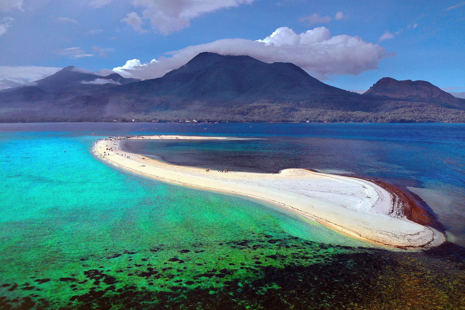
A day here is spent on a hired banca, hopping between islets. Matukad hides a small inland lagoon behind a short, sharp climb; Lahos is a twin beach split by a spit of sand; Cotivas is a low, pale ribbon of shell-sand; and sea caves and coves appear wherever the rock has been undercut by the tide. Between landings the boat crosses reef-studded channels good for a snorkelling stop.
Because it faces the Pacific, Caramoan lives by the weather. In the dry months from March to May the gulf lies calm and the islands are at their best; through the long typhoon season the same water can turn unreachable for days. Come in the window, keep your plans loose, and it repays you with one of the most beautiful and least-trodden island seascapes in the country.
Caramoan Islands: common questions
When is the best time to visit Caramoan Islands?
March to May, the dry Bicol season, brings the calmest crossings and clearest water for island-hopping. This coast faces the Pacific and takes the brunt of the typhoon season (roughly June to December), when boats are often grounded — plan firmly for the dry months and keep buffer days for weather.
How do you get to Caramoan Islands?
Reached via the Bicol hub of Naga (nearest airport) by land to Sabang port, then a boat of roughly 1.5–2 hours across Lagonoy Gulf to Guijalo port near Caramoan town; island-hopping is by hired banca. Crossings depend entirely on sea conditions. Boatmen and a tourism fee are arranged in town.
Added
More wonders to explore