Mù Cang Chải Terraces
📍 Yên Bái Province, northern Vietnam
Mountainsides sculpted into thousands of curving rice terraces by the Hmong people — a living landscape that turns mirror-silver in planting season and molten gold at harvest.
What makes it marvelous
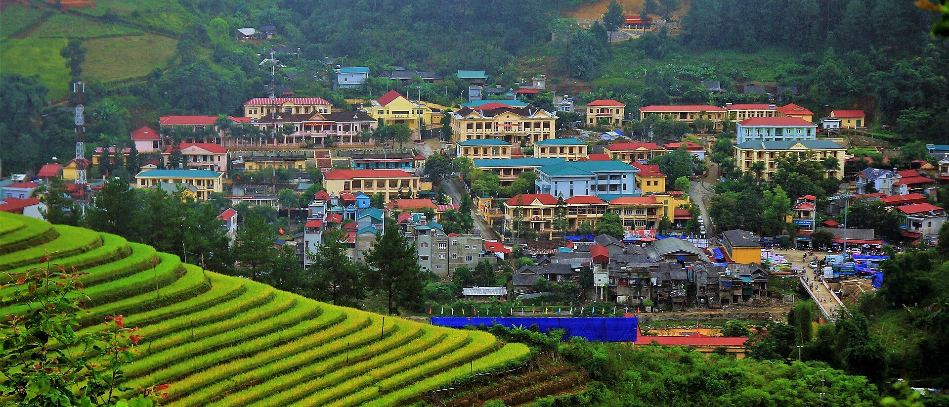
Across the steep hills of Yên Bái in northern Vietnam, generations of Hmong farmers have carved entire mountainsides into stacked rice terraces that follow the contours of the land in vast, sweeping curves. Built without machinery on slopes far too steep for ordinary fields, the terraces trap water and soil, turning near-vertical hillsides into productive farmland — a feat of patient, collective engineering worked out over centuries. Their beauty shifts with the farming year: flooded in early summer, they become a staircase of mirrors reflecting the sky; by September and October the ripening rice turns whole valleys molten gold. This is not wilderness but a landscape shaped by people working with the land, and it ranks among the most beautiful agricultural scenery on Earth.
Why visit
Standing above a valley of golden terraces at harvest, or watching flooded fields mirror the sunset, is unforgettable — and the surrounding villages offer a genuine welcome into Hmong upland life.
What to know before you go
🗓️ Best time
Two windows: around May–June, when the terraces are flooded and mirror-like, and mid-September to mid-October, when the ripe rice turns the hills gold.
🧭 Getting there & access
In Yên Bái Province, roughly a day's drive northwest of Hanoi over the Khau Phạ Pass; explored by motorbike or car along mountain roads, with homestays in villages such as La Pán Tẩn.
Good to know
- Time your visit for the flooded season (May–June) or the gold harvest (Sept–Oct).
- Stay in a village homestay to support local Hmong families.
- Ask before photographing people, and stay on paths between working fields.
Plan your visit
Moderate🧭 Getting there
From Hanoi, then Yen Bai province by road
- Bus or car Hanoi → Mu Cang Chai — roughly 6–8h on mountain roads
- The Khau Pha pass is the scenic and slow part of the journey
- Viewpoints are spread along the valley, reached by motorbike or car
- Total travel
- Most of a day from Hanoi
- Time at site
- 2–3 days to move between the terrace areas properly
- Access
- Open access, but this is working farmland — walking on the terraces means walking on somebody's livelihood, so keep to paths and ask first. A few viewpoints sit on private land and charge a small fee. Landslides close the mountain roads in heavy rain.
🎒 What to bring & consider
- Warm layers — the northern highlands are genuinely cold in winter and chilly at night year-round, quite unlike lowland Vietnam
- Shoes with grip for narrow muddy terrace bunds, which are slippery and drop further than they look
- Motorbike competence, or a hired driver; the passes are steep with minimal barriers
- Cash, as card acceptance is effectively nil outside the cities
- A rain layer for weather that arrives without warning
👁️ What to expect
- Crowds
- Busy during the golden harvest weeks, when domestic photographers arrive in numbers. Very quiet the rest of the year.
- Conditions
- Steep narrow terrace walls, mud after rain, and long winding drives between viewpoints.
- Facilities
- Simple homestays and eateries in the towns; little in between.
- The view
- The terraces mirror water around the pouring season, roughly May to June, and turn gold before harvest, roughly September to October. Outside those windows they are plain green or bare stubble — and the timing shifts each year with the weather, so ask locally rather than booking a fixed date months out.
Times and requirements are approximate and change with season, weather, and local rules — confirm permits, fares, and schedules with operators before you travel.
Natural riches of the area
- Centuries-old hand-built rice terraces on steep mountainsides
- Terrace systems that conserve water and prevent soil erosion
- Monsoon-fed uplands of northern Vietnam
- A living Hmong agricultural culture and knowledge system
Local food
- Sticky rice (xôi)
- Grown on the terraces themselves, often coloured with natural plant dyes.
- Thắng cố & grilled stream fish
- Traditional upland dishes of northern Vietnam's mountain peoples.
- Sơn tra & corn wine
- Local mountain fruit and home-distilled corn spirit of the highlands.
In the steep hills of northern Vietnam, generations of Hmong farmers have carved whole mountainsides into rice terraces that sweep along the contours in vast, curving stairways. Built by hand on slopes far too sheer for ordinary fields, they hold back water and soil, turning near-vertical ground into farmland — a feat of patient, collective engineering refined over centuries.
Their beauty changes with the farming calendar. Flooded in early summer, the terraces become a staircase of mirrors, each one catching the sky; by late September and October the ripening rice turns entire valleys molten gold. This is not wilderness, but something arguably rarer: a landscape shaped by people working with the land rather than against it, still farmed by the families who built it. It ranks among the most beautiful agricultural scenery anywhere on Earth.
Mù Cang Chải Terraces: common questions
How do you get to Mù Cang Chải Terraces?
From Hanoi, then Yen Bai province by road: Bus or car Hanoi → Mu Cang Chai — roughly 6–8h on mountain roads; The Khau Pha pass is the scenic and slow part of the journey; Viewpoints are spread along the valley, reached by motorbike or car. Allow Most of a day from Hanoi.
When is the best time to visit Mù Cang Chải Terraces?
Two windows: around May–June, when the terraces are flooded and mirror-like, and mid-September to mid-October, when the ripe rice turns the hills gold.
How long should you spend at Mù Cang Chải Terraces?
2–3 days to move between the terrace areas properly. Most of a day from Hanoi of travel from Hanoi, then Yen Bai province by road.
What should you bring to Mù Cang Chải Terraces?
Warm layers — the northern highlands are genuinely cold in winter and chilly at night year-round, quite unlike lowland Vietnam Shoes with grip for narrow muddy terrace bunds, which are slippery and drop further than they look Motorbike competence, or a hired driver; the passes are steep with minimal barriers Cash, as card acceptance is effectively nil outside the cities A rain layer for weather that arrives without warning
Do you need a permit or guide for Mù Cang Chải Terraces?
Open access, but this is working farmland — walking on the terraces means walking on somebody's livelihood, so keep to paths and ask first. A few viewpoints sit on private land and charge a small fee. Landslides close the mountain roads in heavy rain.
Is Mù Cang Chải Terraces crowded, and what are conditions like?
Busy during the golden harvest weeks, when domestic photographers arrive in numbers. Very quiet the rest of the year. Steep narrow terrace walls, mud after rain, and long winding drives between viewpoints. Facilities: simple homestays and eateries in the towns; little in between.
Added
More wonders to explore