Preikestolen
📍 Rogaland, southwestern Norway
A sheer, flat-topped cliff jutting 604 metres straight above the Lysefjord — 'Pulpit Rock,' one of the most spectacular and vertiginous natural viewpoints in the world.
What makes it marvelous
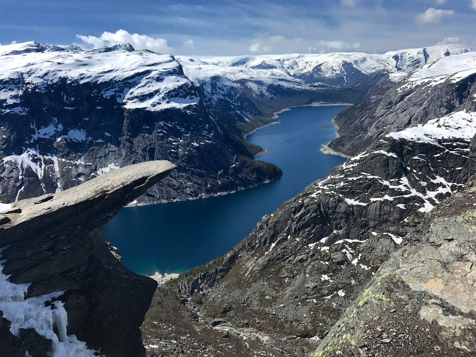
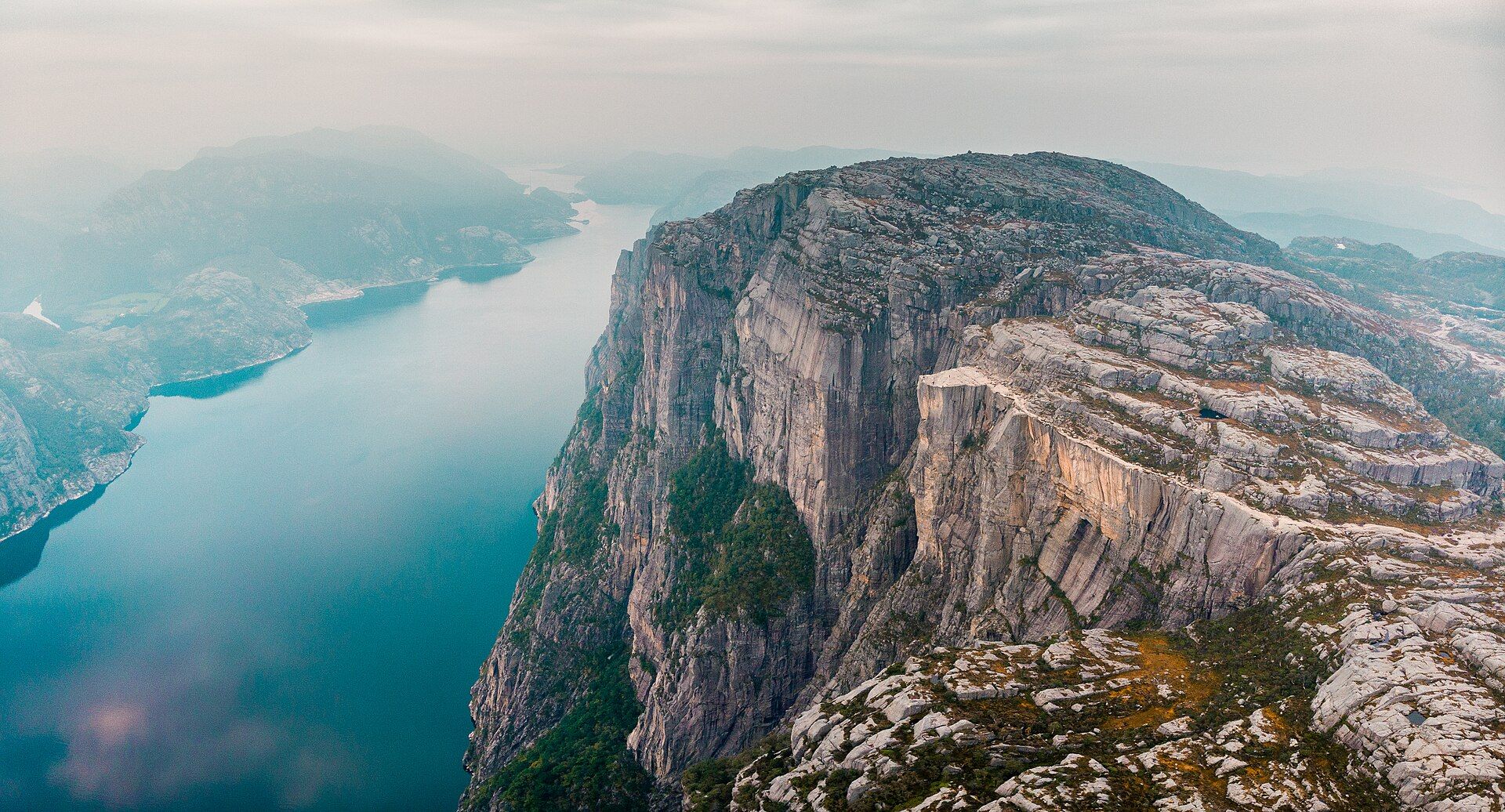
Preikestolen — 'the Pulpit Rock' — is a great slab of granite that ends in a near-perfectly flat platform poised 604 metres directly above the deep blue waters of the Lysefjord. The cliff falls away in a single dizzying vertical drop, a clean sheer face sheared off by frost during the last Ice Age along natural fractures in the rock. From the edge, the fjord winds far below between towering walls, ships reduced to specks, in a view that is both serene and heart-stopping. Reached by a popular but rugged hiking trail through Norwegian upland, it has become one of the most iconic natural viewpoints on Earth — a place where the raw geometry of a glacier-carved landscape is laid out in a single unforgettable image.
Why visit
Hiking up to stand on that flat table of rock, with the Lysefjord plunging 600 metres straight down at your feet, delivers one of the most exhilarating viewpoints in the world — the essence of Norway's fjord country in a single spot.
What to know before you go
🗓️ Best time
Late spring to early autumn (roughly May–September), when the trail is snow-free and safe; the hike can be icy and dangerous outside those months without proper gear.
🧭 Getting there & access
In Rogaland, near Stavanger in southwestern Norway, reached by road and ferry to the trailhead; a roughly 8 km round-trip hike (about 4 hours) climbs to the cliff, with no barriers at the edge.
Good to know
- Hike May–September; the trail can be dangerously icy in the off-season.
- Start early to beat the crowds and enjoy the fjord light.
- There are no railings at the edge — take great care, especially with children.
Plan your visit
Moderate🧭 Getting there
From Stavanger, Norway
- Fly → Stavanger (SVG)
- Ferry and bus, or drive, Stavanger → Preikestolen mountain lodge — roughly 1h–1h30
- Hike lodge → Pulpit Rock and back — about 4h return over roughly 8km
- Total travel
- Around 90 minutes from Stavanger to the trailhead
- Time at site
- Half a day for the hike
- Access
- Open access with a parking charge at the trailhead. The path is well built but there is no barrier of any kind at the cliff edge, and the drop is over 600 metres to the fjord. In winter conditions the route is snow-covered and icy and the official advice is to go with a guide; people do it unguided and it is how the accidents happen. Check trail and weather status with the local tourist board.
🎒 What to bring & consider
- The understanding that there is no railing and no warning line at the top — the rock simply ends, and in wind or on wet stone that is the whole risk of the day
- Proper hiking boots for a rocky, uneven and often wet stone path
- Layers and a windproof, since the plateau is exposed and much colder than the fjord below
- Water and food, because there is nothing on the trail
- A guide, crampons and daylight planning if you go outside the summer season
👁️ What to expect
- Crowds
- Very heavy in summer, with thousands on the trail on good days and a queue for photographs on the rock itself.
- Conditions
- A steady 350m climb on stone steps and boulder sections. Muddy in rain, icy in winter.
- Facilities
- A lodge, café and toilets at the trailhead. Nothing on the route.
- The view
- A figure on the edge of the flat rock with Lysefjord below. Everyone wants it, which is why the practical advice is to start early or go late and accept the light rather than the queue.
Times and requirements are approximate and change with season, weather, and local rules — confirm permits, fares, and schedules with operators before you travel.
Natural riches of the area
- A 604 m sheer cliff above the Lysefjord
- A flat platform sheared by Ice Age frost along rock fractures
- Classic glacier-carved Norwegian fjord scenery
- Upland heath and lakes along the trail
Local food
- Norwegian seafood
- Fresh salmon, cod, and shrimp from the fjords and coast around Stavanger.
- Fårikål
- Norway's national dish of mutton and cabbage, hearty hiking fuel.
- Brunost
- Sweet Norwegian brown cheese, a traditional trail snack on bread.
Preikestolen is Norway’s fjord country distilled into a single, breathtaking image. ‘The Pulpit Rock’ is a great slab of granite that ends in an almost perfectly flat platform poised 604 metres directly above the Lysefjord, its face falling away in one clean, dizzying vertical drop — sheared off by frost during the last Ice Age along natural fractures in the stone.
Stand at the edge and the fjord winds far below between towering walls, ships shrunk to specks on the water, in a view that is at once serene and heart-stopping. A rugged but popular trail climbs to the cliff through Norwegian upland, and the reward at the top is one of the most exhilarating natural viewpoints on Earth — the raw geometry of a glacier-carved land laid out beneath your feet in a way you will never forget.
Preikestolen: common questions
How do you get to Preikestolen?
From Stavanger, Norway: Fly → Stavanger (SVG); Ferry and bus, or drive, Stavanger → Preikestolen mountain lodge — roughly 1h–1h30; Hike lodge → Pulpit Rock and back — about 4h return over roughly 8km. Allow Around 90 minutes from Stavanger to the trailhead.
When is the best time to visit Preikestolen?
Late spring to early autumn (roughly May–September), when the trail is snow-free and safe; the hike can be icy and dangerous outside those months without proper gear.
How long should you spend at Preikestolen?
Half a day for the hike. Around 90 minutes from Stavanger to the trailhead of travel from Stavanger, Norway.
What should you bring to Preikestolen?
The understanding that there is no railing and no warning line at the top — the rock simply ends, and in wind or on wet stone that is the whole risk of the day Proper hiking boots for a rocky, uneven and often wet stone path Layers and a windproof, since the plateau is exposed and much colder than the fjord below Water and food, because there is nothing on the trail A guide, crampons and daylight planning if you go outside the summer season
Do you need a permit or guide for Preikestolen?
Open access with a parking charge at the trailhead. The path is well built but there is no barrier of any kind at the cliff edge, and the drop is over 600 metres to the fjord. In winter conditions the route is snow-covered and icy and the official advice is to go with a guide; people do it unguided and it is how the accidents happen. Check trail and weather status with the local tourist board.
Is Preikestolen crowded, and what are conditions like?
Very heavy in summer, with thousands on the trail on good days and a queue for photographs on the rock itself. A steady 350m climb on stone steps and boulder sections. Muddy in rain, icy in winter. Facilities: a lodge, café and toilets at the trailhead. Nothing on the route.
Added
More wonders to explore