Shiretoko
📍 Hokkaido, northern Japan
A wild peninsula at the edge of Japan where drift ice arrives each winter — feeding an extraordinary food chain of brown bears, salmon, sea eagles, and whales.
What makes it marvelous
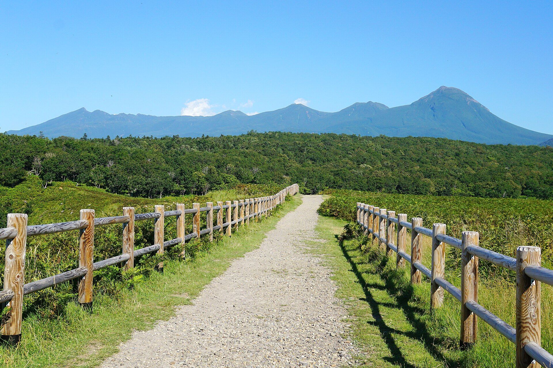
Shiretoko juts off northeastern Hokkaido into the Sea of Okhotsk, and its name comes from the Ainu for 'the end of the earth' — apt for one of Japan's last true wildernesses, with no road running its length. Its wonder is a rare natural mechanism: each winter, this is the lowest-latitude place in the Northern Hemisphere to receive seasonal drift ice. When that ice retreats in spring, it seeds a plankton bloom that drives one of the richest marine food chains anywhere, feeding fish, then salmon returning up the rivers, then the animals that wait for them. Brown bears gather at the streams in remarkable density, Steller's sea eagles and white-tailed eagles winter here in numbers, and whales, orcas, and seals work the coast. Volcanic peaks, waterfalls falling straight into the sea, and old-growth forest complete the picture. It is a UNESCO World Heritage Site.
Why visit
Few places link ice, ocean, forest, and predator so visibly — cruising beneath sea cliffs where bears forage on the shore, or standing on winter drift ice with eagles overhead, is unlike anywhere else in Japan.
What to know before you go
🗓️ Best time
Summer (roughly June–September) for hiking, boat cruises, and bear viewing; February for the spectacle of drift ice and wintering eagles.
🧭 Getting there & access
In far northeastern Hokkaido, reached via Memanbetsu Airport and the towns of Utoro or Rausu; a road crosses the peninsula in summer, and boat cruises reach the roadless coast.
Good to know
- Take a coastal boat cruise — much of the peninsula has no road access.
- This is dense brown bear country; follow all guidance and never approach.
- Come in February for the drift ice and eagles, summer for bears and hiking.
Plan your visit
Moderate🧭 Getting there
From Utoro, Hokkaido, Japan
- Fly Tokyo → Memanbetsu (MMB), Hokkaido — roughly 1h45
- Drive Memanbetsu → Utoro on the Shiretoko peninsula — about 2h
- Join a guided walk of the Shiretoko Five Lakes, or take a coastal wildlife cruise
- Total travel
- A flight plus a two-hour drive from the airport
- Time at site
- Two or three days
- Access
- Shiretoko is one of Japan's wildest corners, and it is serious brown-bear country. The ground-level path around the Shiretoko Five Lakes can only be walked with a registered guide during the bear-active months; outside those, an elevated boardwalk stays open to all. Book the guided walk ahead in season. The peninsula's other faces are seasonal too: winter brings the drift ice that packs against the coast around Rausu, best seen from a boat or a guided ice walk. Roads over the peninsula close in winter. Confirm guide requirements and seasonal access locally before you plan.
🎒 What to bring & consider
- A booked, registered guide for the Five Lakes ground path in the bear season, which is a strict requirement and not a formality
- Bear-aware discipline throughout — make noise, carry nothing that smells of food loose, and follow the guide's lead
- Warm, waterproof layers for a cool, damp peninsula, and far warmer still for the winter drift-ice trips
- A booking for the wildlife or drift-ice cruise, which is the way to see the bears, whales and eagles from the water
- A hire car, since the peninsula's sights are spread out and public transport is thin
👁️ What to expect
- Crowds
- Modest. Utoro and the Five Lakes see visitors in summer; the peninsula still feels remote and wild.
- Conditions
- Cool, wet and forested in summer; frozen and ice-bound in winter. Genuinely wild throughout.
- Facilities
- Lodging and food in Utoro and Rausu, plus visitor centres. Little in the park interior.
- The view
- The Five Lakes mirroring the still-snow-streaked Shiretoko peaks on a calm morning, or the winter coast packed with drift ice. A brown bear glimpsed from the cruise boat is the wildlife prize.
Times and requirements are approximate and change with season, weather, and local rules — confirm permits, fares, and schedules with operators before you travel.
Natural riches of the area
- The lowest-latitude seasonal drift ice in the Northern Hemisphere
- A plankton bloom driving an exceptionally rich marine food chain
- High-density brown bears, Steller's sea eagles, whales, and orcas
- Old-growth forest, volcanic peaks, and sea-cliff waterfalls
Local food
- Hokkaido seafood
- Salmon, scallops, sea urchin, and crab from the cold northern seas.
- Ikura & salmon dishes
- Salmon roe and grilled salmon, central to Hokkaido and Ainu tradition.
- Jingisukan
- Hokkaido's grilled mutton dish, a regional specialty.
Shiretoko juts off the northeastern tip of Hokkaido into the Sea of Okhotsk, and its name comes from the Ainu for ‘the end of the earth’ — fitting for one of Japan’s last true wildernesses, with no road running its length. What makes it extraordinary is a piece of natural machinery: this is the lowest-latitude place in the Northern Hemisphere to receive seasonal drift ice.
When that ice retreats each spring, it triggers a plankton bloom that drives one of the richest marine food chains anywhere. Fish thrive, salmon run up the rivers, and the animals that depend on them gather in remarkable numbers — brown bears at a density rarely seen, Steller’s sea eagles and white-tailed eagles wintering in force, whales and orcas working the coast. Add volcanic peaks, old-growth forest, and waterfalls dropping straight into the sea, and it’s clear why this UNESCO World Heritage peninsula stands apart from anywhere else in Japan.
Shiretoko: common questions
How do you get to Shiretoko?
From Utoro, Hokkaido, Japan: Fly Tokyo → Memanbetsu (MMB), Hokkaido — roughly 1h45; Drive Memanbetsu → Utoro on the Shiretoko peninsula — about 2h; Join a guided walk of the Shiretoko Five Lakes, or take a coastal wildlife cruise. Allow a flight plus a two-hour drive from the airport.
When is the best time to visit Shiretoko?
Summer (roughly June–September) for hiking, boat cruises, and bear viewing; February for the spectacle of drift ice and wintering eagles.
How long should you spend at Shiretoko?
Two or three days. A flight plus a two-hour drive from the airport of travel from Utoro, Hokkaido, Japan.
What should you bring to Shiretoko?
A booked, registered guide for the Five Lakes ground path in the bear season, which is a strict requirement and not a formality Bear-aware discipline throughout — make noise, carry nothing that smells of food loose, and follow the guide's lead Warm, waterproof layers for a cool, damp peninsula, and far warmer still for the winter drift-ice trips A booking for the wildlife or drift-ice cruise, which is the way to see the bears, whales and eagles from the water A hire car, since the peninsula's sights are spread out and public transport is thin
Do you need a permit or guide for Shiretoko?
Shiretoko is one of Japan's wildest corners, and it is serious brown-bear country. The ground-level path around the Shiretoko Five Lakes can only be walked with a registered guide during the bear-active months; outside those, an elevated boardwalk stays open to all. Book the guided walk ahead in season. The peninsula's other faces are seasonal too: winter brings the drift ice that packs against the coast around Rausu, best seen from a boat or a guided ice walk. Roads over the peninsula close in winter. Confirm guide requirements and seasonal access locally before you plan.
Is Shiretoko crowded, and what are conditions like?
Modest. Utoro and the Five Lakes see visitors in summer; the peninsula still feels remote and wild. Cool, wet and forested in summer; frozen and ice-bound in winter. Genuinely wild throughout. Facilities: lodging and food in Utoro and Rausu, plus visitor centres. Little in the park interior.
Added Updated
More wonders to explore